Buying land around Reno looks simple until access and easements come up. A driveway that seems obvious can be private, a dirt track can fail a lender’s test, and a utility strip can limit where you build. If you are evaluating acreage or a buildable lot in Washoe County, understanding legal access and easements is essential. In this guide, you will learn how access works here, what to verify before you close, and how to avoid costly surprises. Let’s dive in.
Legal vs. physical access in Reno
You can often drive to a parcel, but that does not mean you have a legally protected right to do so. Physical access is the actual ability to reach the property. Legal access is a recorded right to use a road or right of way that cannot be blocked without violating property rights.
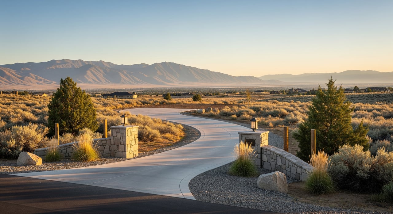
Land in and around Reno may front a public road maintained by the City of Reno, Washoe County, or the Nevada Department of Transportation. Parcels on private roads rely on recorded easements or agreements. Your goal is to confirm that a recorded right to ingress and egress exists and that it is acceptable to your lender and title company.
Public vs. private road access
- Public road or public right of way: Dedicated to and maintained by a public agency. Parcels abutting a recorded public right of way typically have legal access.
- Private road: Owned and maintained by private parties. Legal access depends on recorded easements, deeds, or agreements.
- Jurisdiction matters: Maintenance and rules differ by agency. Confirm if you are on a city, county, state route, or private road and who maintains it.
Common easement types you will see
- Recorded access easement: A written, recorded grant for ingress and egress across another parcel. This should appear in the title report and at the Recorder.
- Easement by necessity: May be created when a parcel is landlocked. This is fact specific and often requires legal review or court action.
- Prescriptive and implied easements: May arise from historic use or how land was split and used. These require careful legal and title analysis in Nevada.
- Utility easements or public utility easements: Rights for utility companies to install and maintain services. These often run along lot lines and appear on recorded plats.
- Public rights of way: Broad corridors for roads and utilities managed by public agencies.
How to verify access step by step
Follow this sequence to save time and avoid gaps.
1) Order the preliminary title report
Ask a local title company for a preliminary title report or title commitment. Review all listed exceptions, especially recorded easements, road dedications, and any covenants, conditions, and restrictions. Request full copies of every referenced document, not just the summary pages.
2) Pull recorded maps and easements
Search recorded plats, deeds, and easements with the Washoe County Recorder. Plats often show public utility easements and road dedications with dimensions. Pair this with the Washoe County GIS Parcel Viewer to visualize parcel boundaries and recorded map layers.
3) Commission a boundary or ALTA survey
An ALTA or NSPS land title survey maps boundaries, visible improvements, and plots recorded easements on the ground. It is the best way to verify where an ingress and egress easement sits, its width, and whether any fences, driveways, or structures encroach. You can reference the ALTA and NSPS survey standards to understand what is typically shown.
4) Confirm road jurisdiction and maintenance
Call the correct agency to verify whether a road is public or private and who maintains it. Use Washoe County Public Works for county roads, City of Reno Public Works for city streets, and NDOT for state routes. If the road is private, ask for any recorded road maintenance agreements or districts that spell out cost sharing and repair obligations.
5) Inspect physical access on site
Visit the parcel and drive the route that the documents describe. Check for gates, seasonal washouts, steep grades, or bridges. Talk to nearby owners about historic use and maintenance. This step helps you spot conflicts early and confirms that the paper route is practical.
6) Verify utilities and utility easements
Contact local providers for service availability and whether new service needs additional easements. In the Reno area, start with NV Energy for electricity, Southwest Gas for natural gas, and Truckee Meadows Water Authority for water and sewer in many service areas. Compare provider responses with recorded plats and your survey to avoid placing driveways or structures in utility corridors.
7) Check BLM adjacency and access rules
If your parcel borders federal land, confirm whether you can cross it or improve an access route. Motorized use and new routes are controlled by travel management. Rights of way across federal land typically require authorization. Review BLM’s programs and maps on the Bureau of Land Management site and collect any documents that affect your parcel.
8) Get lender and title sign off
Many lenders and title companies require a recorded public road or a recorded access easement. Ask early what documentation your lender and the title underwriter will accept as evidence of legal access. This prevents last minute surprises.
Utilities and PUEs in Washoe County
Public utility easements help get power, water, sewer, gas, and communications to your site, but they also limit what you can build in those corridors. PUEs commonly run along lot lines or through lots and can already contain underground lines or poles. Surveys show where these easements are located and their widths.
It is common to see overlapping easements. A driveway easement can cross a utility easement, and drainage easements can run through the same area. The recorded language controls priority and restrictions, and utilities often have strong rights for maintenance. Before designing your site plan, confirm PUE widths on the plat and have your surveyor stake the easement boundaries in the field.
BLM adjacency: what to know
Bordering BLM land can be a benefit, but it does not automatically create a private right to cross or improve access. Motorized travel is regulated by BLM travel designations, and new or improved access across federal land often requires an authorized right of way. If your parcel is landlocked, you may need either a private easement across neighboring land or a BLM authorization, depending on the route.
Ask for any existing BLM rights of way or travel management information affecting your area. Combine that with title documents and a survey to map the real options to reach your parcel.
Maintenance, costs, and disputes
Public roads are maintained by the responsible agency. Private roads rely on recorded maintenance agreements, CC&Rs, or informal neighbor practices. Good agreements spell out cost sharing, who decides on repairs, how to handle disputes, and whether liens can secure unpaid contributions.
Common issues include blocked access, unauthorized gates, or disagreements over grading and snow removal. If you buy into a private road, collect copies of the maintenance agreement and ask whether there are current or pending assessments. For unresolved or ambiguous easements, a Nevada real estate attorney can help interpret rights and options.
Buyer checklist for Reno parcels
Use this quick checklist to keep your due diligence on track.
- Preliminary title report or commitment, plus copies of all recorded easements and CC&Rs
- Recorded plat map and relevant deeds from the Washoe County Recorder
- ALTA or NSPS survey plotting all easements and visible access
- Written confirmation of road jurisdiction from Washoe County Public Works, City of Reno Public Works, or NDOT
- Utility availability letters from NV Energy, Southwest Gas, and Truckee Meadows Water Authority
- BLM maps or right of way documentation if the parcel borders federal land via the BLM site
- Lender and title underwriter acceptance of legal access evidence
When to call in pros
Bring in a surveyor when the location or width of an easement is unclear, or when you need to design a building envelope around multiple easements. Ask the title officer about endorsements that address access. If an access route is based on historic use, or if a neighbor claims a prescriptive right, consult a Nevada real estate attorney before you remove contingencies.
If you are moving fast on a promising parcel, the right sequence is title report, Recorder and GIS documents, survey, and written agency confirmations. This workflow will uncover most issues early and keep your financing on track.
Work with a local guide
Access and easements are solvable, but only if you confirm the details early and in writing. A clear paper trail, a plotted survey, and agency confirmations will protect your budget and your timeline. If you want a second set of eyes on access language, road agreements, or utility logistics anywhere in Reno or greater Washoe County, connect with a local land specialist who handles these issues every week.
Have questions on a specific parcel or need help prioritizing the checks above? Reach out to Kimberlie Buffington for practical, Northern Nevada land guidance.
FAQs
What is legal vs. physical access on Reno land?
- Physical access means you can drive to the property, while legal access means a recorded right like a public road or recorded easement that a lender and title company will accept.
How do I confirm a private road is maintained?
- Contact the appropriate public works office to verify jurisdiction, then review recorded road maintenance agreements or CC&Rs that define cost sharing and repair obligations.
Do lenders require recorded access for land loans?
- Often yes, many lenders and title companies require evidence of legal access such as a recorded public right of way or a recorded ingress and egress easement.
Can I build a driveway across a utility easement?
- Usually not without restrictions, utility easements often prohibit obstructions and grant broad maintenance rights, so confirm the recorded language and your survey before building.
Does bordering BLM land guarantee access to my parcel?
- No, crossing BLM land is governed by travel management rules and rights of way, and new or improved access typically requires authorization or a private easement route.